Surveying is the science and craft of measuring and determining the relative positions of points, lines, and objects on the earth’s surface. The information gathered through surveying is used to create maps, design and build structures, and manage natural resources. A surveyor must have a thorough understanding of mathematics, geology, and technology to accurately measure and analyze data.
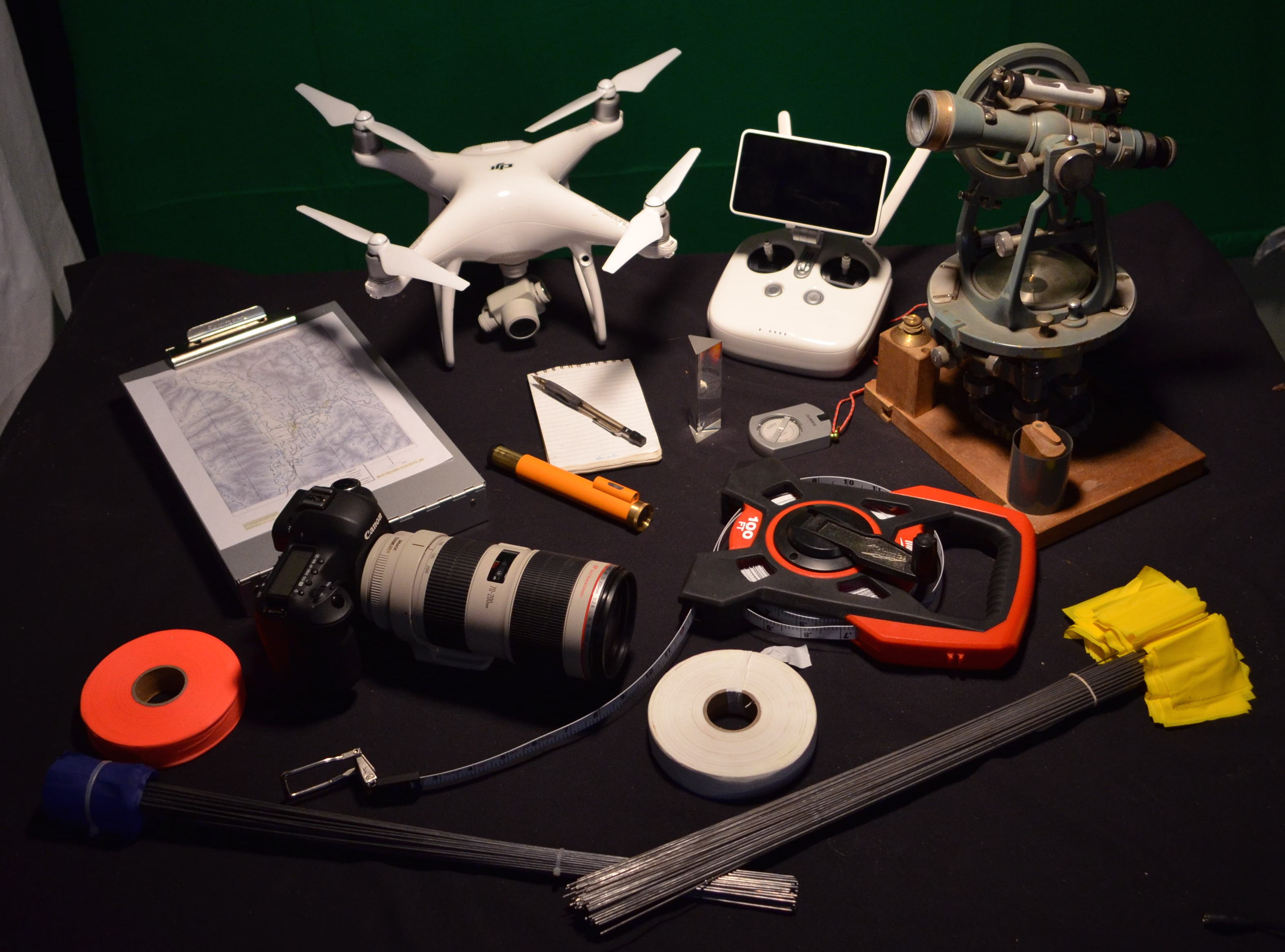
The instruments used by surveyors can be grouped into two categories: traditional and modern. Traditional instruments include the A-frame level, the water level, the transit, and the chain. The A-frame level is a simple device used to determine if a surface is level by comparing the level of a bubble in a tube to a line marked on the frame. The water level uses the same principle but with a clear tube filled with water. The transit is a more complex instrument that has both a level and a compass, used to measure angles and distances. The chain is used to measure distances.
Modern instruments include laser levels, drones, and GIS (Geographic Information Systems). Laser levels emit a laser beam that can be used to determine if a surface is level. Drones equipped with sensors can be flown over a site to gather data and produce high-resolution images. GIS is a computer-based system that combines mapping, data analysis, and presentation tools to analyze and present geographical data.
Why do we need people who know how to survey? Surveying is crucial in many aspects of our daily lives. For example, surveying is used in the construction of buildings, roads, bridges, and other structures to ensure that they are properly placed and aligned. Surveying is also used in the management of natural resources, such as forests and minerals, to ensure that these resources are used sustainably. Additionally, surveying is used to create maps, which are essential in navigation, urban planning, and disaster response.
The role of the surveyor has evolved with technology. Surveyors now use sophisticated computer software, such as GIS, to process and analyze data, as well as produce accurate maps and diagrams. They also use drones, laser levels, and other advanced tools to gather data more quickly and accurately. Despite these technological advancements, the fundamental principles of surveying remain the same. Surveyors must still have a strong understanding of mathematics and science to accurately measure and analyze data.
Ultimately, the surveying tools necessary to design small scale homestead solutions are within reach and the skills needed to operate them can be taught in less than a day at a standard Permaculture Design Course. It’s a skill that’s worth developing if you’re gonna work with land at all.